Guanacaste Paragliding Guide: Nosarita and Santa Elena
By Harry Knight | INFO: +506 8940-2397 | [email protected]
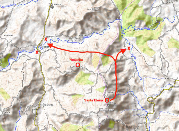
Nosarita and Santa Elena are located on opposite sides of the same hill and offer excellent access to XC flying in the Nicoya Mountain Range, as well as the possibility of landing on the beaches around Sámara and Nosara. Nosarita faces north, while Santa Elena faces east. Both sites have direct vehicle access via 4×4 trails or a short walk of about 300 m from the main road.
Santa Elena, with its higher elevation and east-facing slope, may seem like the most obvious choice, but landing too low there has much more serious consequences, since the landing is more technical and recovery takes considerably longer. Nosarita is logistically a much easier place to fly, with simple landing options and very quick recoveries.
Local Taxis / Pickup: Jairo: +506 8632 8847 | Santiago: +506 8356-2058
NOSARITA
Location = 10.022249, -85.484320
Best wind direction = 340° – 060° (030°–050° best)
Takeoff altitude = 600 m
Height above the LZ = 450 m
Distance to the LZ = 2.2 km
Glide ratio to the LZ = 4.9 : 1

SANTA ELENA
Location = 10.005531, -85.470294
Best wind direction = 040° – 120°
Takeoff altitude = 760 m
Height above the LZ = 540 m
Distance to the LZ = 2.7 km
Glide ratio to the LZ = 5:1


Access points to the overhangs
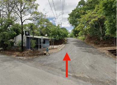
Both sites are accessed via the same route. Drive to the town of Belén on Route 150, then turn onto Calle Belén (there’s a barbershop on the corner), which winds up the mountain toward Santa Elena. The road is mostly gravel, with some paved sections, and is generally in good condition, even during the rainy season.
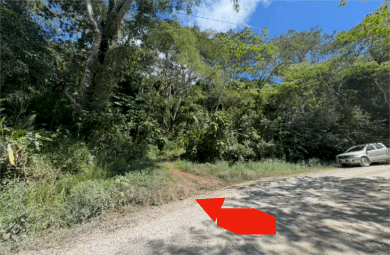
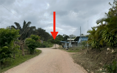
The entrance to Nosarita is at 10.021295, -85.485212.
The gate is usually open, but if it's closed, you can contact the owner, Pedro, at +506 8527 3569, although sometimes it's faster to just walk up.
The entrance is about 4 km down the road. About 200 m past a sharp right-hand curve, look for this entrance on the left. With a 4×4 vehicle, you can usually drive up to the launch site, where there is space to park several vehicles. However, the road is not regularly maintained and may be in poor condition.
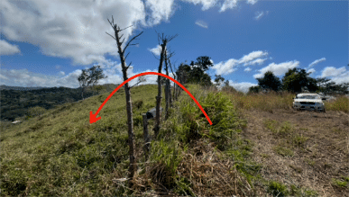
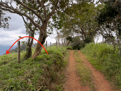
If you park down below and walk up, it’s only about 300 m. At the top, you’ll find a flat area with a small shed. The actual takeoff point is the pasture on the other side of the fence. There’s no gate, but it’s easy to get past the fence, and the landowners don’t mind as long as you don’t cause any damage.
The entrance to Santa Elena is at 10.007603, -85.470881.
The access road is 7 km from the turnoff in Belén. As you pass through the town, look for the school on the right, and when the road turns left, take the dirt road that continues straight ahead. It’s a very steep climb and is recommended only for 4×4 vehicles or motorcycles. Other vehicles can park near the school; from there, it’s about a 300-meter walk to the launch site. At the top, the path levels out and offers an excellent view to the east. There’s no gate at the top (it’s at the bottom), but you can easily go over or under the fence. The landowner is okay with this as long as you proceed with care.
You can unload your equipment here, but please DO NOT park at this spot, as the road is narrow and the landowner needs access. After unloading, continue down the road, which leads back down to the main highway.
Turn left and park near the school; from there, you can walk up without having to carry your equipment.
Nosarita
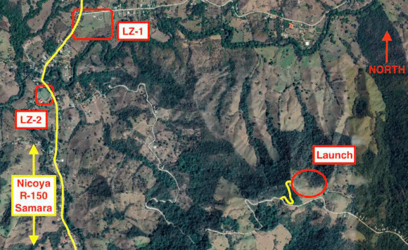
Before crossing the fence into the launch area, take a moment to locate the landing zones (LZs) in the valley, as they are obscured by the trees to the left from takeoff. They will become visible again once you are airborne, but it is important to know what to look for. The site allows for top landings, but be careful with the
changes in wind direction as the sea breeze moves inland later in the day. Use the right side of the field, where there are no trees, and avoid being blown behind the hill by the wind. With strong winds from the north, be aware of possible turbulence (rotors) coming from Cerro Ojochillal, across the valley. At lower altitudes, the air can feel quite choppy. Don’t linger around the launch if you’re losing altitude. If the area in front of the launch isn’t lifting, the bowl to the left is a good place to find thermals. The ridge running down from there toward LZ-1 may have some bubbles, but the area around LZ-1 tends to produce thermals frequently. It’s best to arrive a little higher so you can look for a “low save.”.
Landings
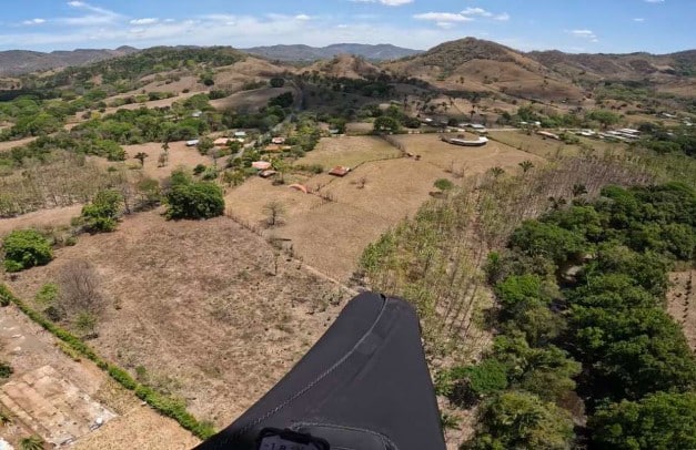
LZ-1 Belen Bullring (10.035102, -85.500190):
A large, open field, usually without livestock. Fences may change over time, so it’s a good idea to check them before heading up. There’s usually a flag near the crossing that indicates the wind direction. Be careful of gusty winds in the valley and possible wind vortexes with strong northerly winds.

LZ-2 Belen Plaza (10.029028, -85.503844):
A good-sized soccer field with a low fence. Watch out for the power lines. The school buildings to the southwest have flags. Be very careful of changes in wind direction when the sea breeze picks up later in the day; here, the wind shifts sooner than it does elsewhere.
Saint Helena
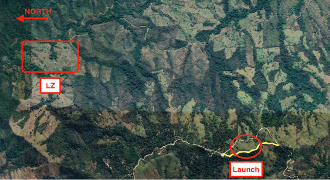
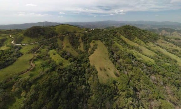
Santa Elena is an excellent spot because of its elevation and its east-facing slope, which catches the morning sun and the prevailing wind. Often, the first cumulus clouds of the day form right above the takeoff area. You can’t see the landing zones (LZs) from the launch site, so study the maps carefully and have a clear flight plan. The emergency landing zone (“bomb-out”) is about 2 km to the north, following the valley. The pastures just below the launch site aren’t good options, even though they might look like they are from above.
A better option is to fly north through the valley, and if you manage to gain about 100 m above the takeoff elevation, you’ll be able to cross over into the Nosarita Valley and land at one of the landing zones in Belén. The site allows for top landing, but be very careful not to be pushed toward the tree line or, worse yet, behind the hill, as landing options are very limited. Don’t stay near the launch if you’re losing altitude. Fly away from the hill to go around the ridge with the soccer field and then fly north along the ridge. With any luck, you’ll find thermals at some point, but it’s not a good idea to arrive low over the landing zone the first time you fly at this site.
Landings
Santa Elena LZ (10.028925, -85.459568):
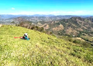
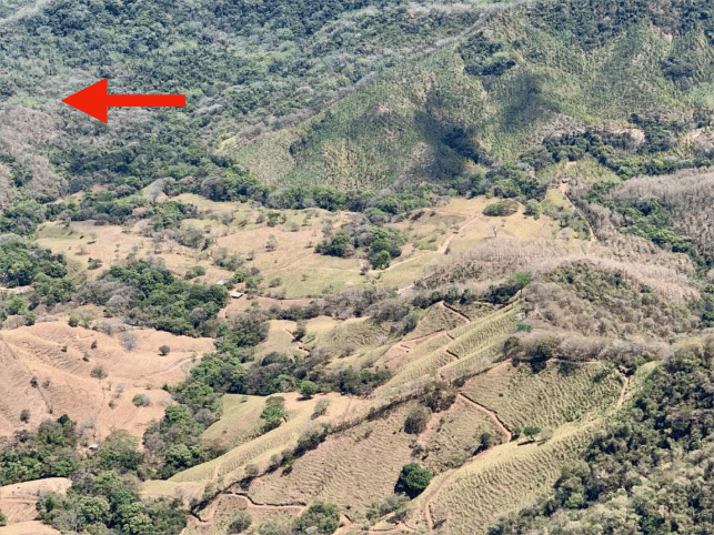
These are the airstrips as seen from the ridge.
They’re your best option if you can’t get out of the valley. Watch out for scattered trees; avoid staring at them. Cell service is poor in this valley, and getting out requires a 4×4 vehicle, since there are a couple of river crossings from Belén.
XC in the area
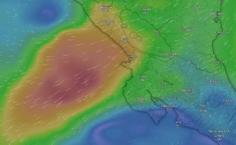
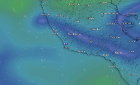
Trade winds. Many people think that Guanacaste is too windy for regular flying, and further north, near Liberia, this may be true. There, the east-west trade wind is channeled through the mountainous pass of Lake Nicaragua and then disperses, generating a steady northeast wind near the border, which normally does not extend much south of Nicoya.
At times, especially in January, high-pressure systems in the Caribbean intensify this phenomenon. Sometimes called the Papagayo wind, it can cause very strong winds during takeoffs for several days. The good news is that these conditions are easy to predict and are usually detected several days in advance. The second phenomenon is convergence, which occurs when the sea breeze blows in from the south and meets the northeast trade winds.
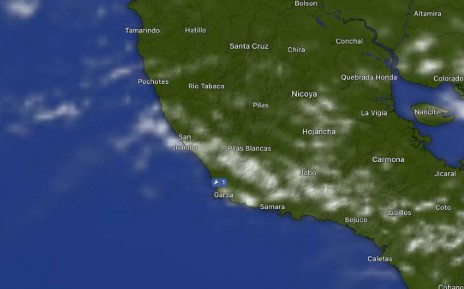
This convergence line forms most days during the flying season, starting near the coast and moving inland as the day progresses. It can generate strong lift and allow for XC flights toward Nosara or along the peninsula.
toward the east. You can usually track the convergence’s progress by observing a line of cumulus clouds forming over it. Keep in mind that this line usually moves past the takeoff areas later in the day, causing a 180° shift in wind direction and, at times, blocking the sun in the afternoon.
Airspace
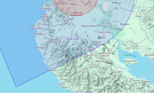
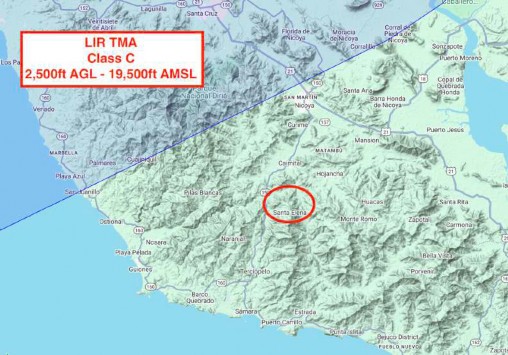
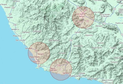
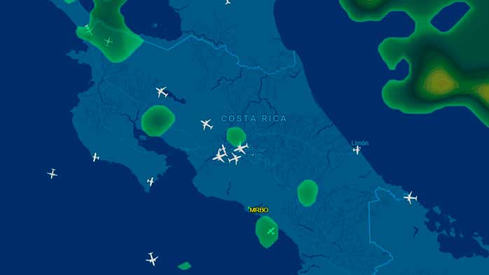
There is a significant airspace area in the region. The TMA for Liberia Airport (MRLB) is Class C airspace and extends in a strip just north of Nicoya to San Juanillo, on the coast. The lower limit is 2,500 ft AGL (760 m), which means that in the mountains you can still fly up to about 1,700 m (5,500 ft), but in lower-lying areas north of Diriá National Park, this limit can be quite restrictive. Many websites do not clearly define Costa Rica’s airspace, so accidental incursions do not usually affect XC claims. Even so, there is quite a bit of local traffic flying IFR flights toward Liberia at similar altitudes, and they do not expect to encounter paragliders. It’s also important to be aware of activity at these three active airfields. They have no airspace restrictions, but it’s best to stay alert. If you have a radio with an aviation band, the Unicom frequency is 122.000 MHz.
Nosara (MRNS):
Very active, with small commercial and charter flights. They usually fly along the coast and avoid the mountains.
Monte Reina (MRMR):
Fly With Us's private airstrip for ultralight aircraft, offering frequent low-altitude sightseeing flights around Sámara.
Nicoya (MRNC):
Generally inactive, but with occasional medical flights.