
PARAGLIDING COSTA RICA TRAVEL GUIDE
Costa Rica Paragliding Map Sites

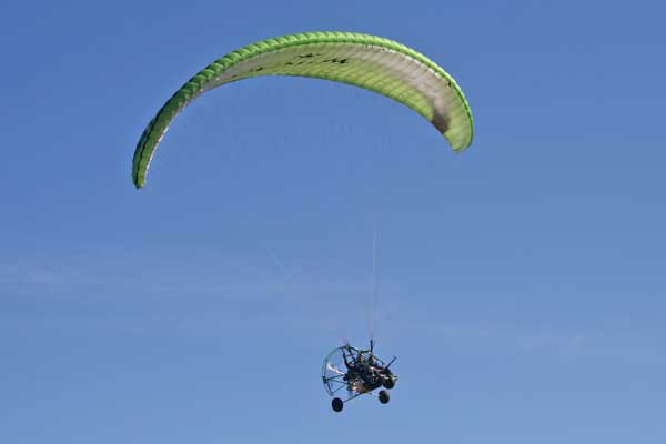
Costa Rica is a country known for its natural beauty, diverse fauna and flora, and stunning scenery. But it is also a top destination for paragliding enthusiasts. With over 30 flying zones and nearly 60 takeoffs spread across the country, Costa Rica offers a variety of options for all experience levels. From beginners looking for a quiet place to practice their first flights, to experienced pilots looking for new challenges, Costa Rica has something to offer everyone.
This guide is the ultimate resource for paragliders visiting Costa Rica. It includes information on all of the country’s flying zones, as well as tips for flying safely and responsibly. Each flying zone is described in detail, including information on terrain, weather conditions, and takeoffs and landings. The guide also includes maps and images of each zone, so pilots can plan their flights in advance.
In addition to information on the flying zones, the guide also includes an interview with NIVIUK’s R&D design team. In this interview, NIVIUK engineers talk about the design process of their paragliders, and offer tips for choosing the right paraglider for your needs.
FREE PDF DOWNLOAD!!!


PARAGLIDING SITES IN COSTA RICA
View Costa Rica paragliding map sites mashed up with live weather observations, forecasts and webcams to see which sites are flyable right now – all over the country. Paragliding map is a fully supported product. If you have any problems, please let me know and I will help you personally to find your favorite spot.
MOST FAMOUS FLYING SITES IN COSTA RICA
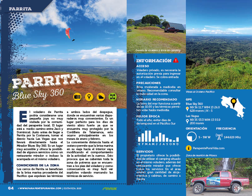
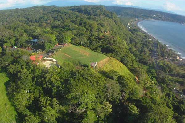
Jaco
Jaco is a tourist town with a huge bay and a long, beautiful beaches. To look into the Pacific quickly get used to, and you’ll love it, if only because of every moment beautifully plopping sun. Alternate days and it almost seems that in addition to rolling around on the beach and the seafood tasted nothing to do here. But that it is necessary to travel with a paraglide, to be more in motion.
 Practically right on the Boulevard in the northern part of town after crossing route number 34 follows a dirt road leading along the ridge rising straight up on the runway at an altitude of 220 meters. Arrive there really is simple. Take-off is lava, gradually sloping, a day ahead of local pilots left her covered with gravel, so local conditions brand ideal for novice pilots. Landing strip is a huge green space directly below the start, so also quite easy.
Breezes from the Pacific operates regularly and is on soaring a relatively small space, or 100 meters before the start of the regular ripping thermals, it’s easy to jump in and look around. Range to the beach is possible, but it will not be easy, it’s a plane flying into the wind.
On the contrary gain height and jump over a small valley to the southeast is another option to look after the local hills.
Around and around – flying over Jako is simple, pleasant, but a local affair. If local will take care of the runway, probably will soon be charged.
Dominical
When the bad weather in Costa Rica, and also it is necessary to become the beginning of January, so pilots will be sent to one place – at Dominical. It’s a flight terrain in the southeast of the country, well-shielded high ridge Mountains National Park Chirripó. This gives Dominical truly unique microclimate and flies here though on the east or north side of Costa Rica Duje and rain. As an airfield serving Long Beach Dominical or small football field just ahead.
The range on the runway but even more cowgirl. That’s if you really reading this description and you rely on the routes from Google Maps. I do not know where comrades made a mistake, but these maps provide truly beautiful and dramatic experiences, but without achieving the planned goals. On the runway do you get two possible ways.
 The first route is very long and technically demanding. Of the number 243 road leading from San Isidro to Dominical turn to gravel in the middle of the map and start to drive. Therefore, only the hardcore people with higher car drivers 4 x 4 can rich it. With a normal car to drop it, get you into a trap from which you cannot get out on your own. Want to lend a rope from local residents, is the earliest ever find someone and then release the same energy, ingenuity and patience as you would like them to make broth from a single when you have in your backyard. The second route is shorter and we can say that the only proper. If you know when and where to turn. In principle, it comes on top arcade don’t go on smaller ways, even though it looks on the map and take the sharp concrete way to the top of the ridge. Looking back on the left you will see far sharper path leading somewhere up in the jungle, and after that you definitely want to go even with four-wheel drive. And this is the one for which you have to ride, leads one to the transmitter and around him on the runway. When you move it, you realize that it is not so terrible, and it was probably some kind of optical illusion or unnecessary stress passengers. Runway is hidden behind two huge concrete fountains where there is no water and locked by a high fence. Key from the fence has Roger – A local administrator of this area. Stretch the crack between the iron and the concrete goes only to those who doesn’t like a good food and drink. The parachute is there but it does not fit, so in the context of social conventions call Roger and he would arrange it. Of course, each service has its price, the runway is paid, 4,000 or 30,000 Colon Colon for a group of eight or more people. The whole fun is to prepare for the construction of a hotel and restaurant, it is likely that over time this description becomes irrelevant, because up to lead a well-marked and rutted path.
Precisely because it is a building plot is grassy runway, ideally straight without any inclination and it’s always complications. If you do not paraglide completely under control, lax rushes and hop on the edges down, there’s a fair chance that you will appreciate the help athletes with a machete, which help you for a small bribe chisel out of the jungle back to our world. The inclination is large, dense vegetation, so that the soft, the chance of serious injury, thus relatively low.
Flying is easy to Dominical, a combination of sloping and thermal flying everywhere you look, the option is here somewhere fly away, but everything is limited by landing in the jungle. And so it comes to flying on a beautiful large, but the sides rather limited space. When you add to that but the Pacific with sunset, so you absorb Dominical and forgive him, even the jungle. An interesting option is to fly over the beach to Dominical and soaring still a long mountainous edge separating the two beaches. By the way, this place is also a lot, which can land and from which they can launch. From the height goes well seen. To what extent is this place piles used and who is the owner – hard to say. Car is available, but rather unkempt. And Roger would prefer to have asked, even though it is a nice guy, it’s not what they wanted to present.
Caldera
A simple start, although only 100 meters high but it 2.3 kilometers long edge clear, steady wind ideal for the beginner years, commercial tandem flights and endless embankment – this is the starting point of the Caldera. Access to the starting point is quite simple, since local tandem pilot and really likable guy JC make this place really nice. Nemaclys – that’s the name of this area with a view, restaurants, parking and a grassy slope to the simplest takeoff and landing top too. A bit special is its lower part, which is to end little changed in the short straights, but it certainly gives a chance to those who would start wrong and needed to be something to stop it. Also, it is definitely stable place for top landing, that he INTERCEPT behind the right side of the runway, over which the vertical wind component does not show much.
 Attention is needed to pay for the canopy overshoot, which tries to adjust the airflow from beneath the edges Cliff. When the canopy to brake too early, of course, falls without a lift back to earth. Strong flow is on the edge of the cliff and rehearse the routine starts to cross here is risky for local pilots and a little incomprehensible. It can be morning train to Long Beach under Caldera, which is also safe and easy to be useful with the landing surface.
Starting area is subject to fees, you pay somewhere around 3,000 Colony, it seems that too by the way the owners fall in love with this area. And what concerns the possibility of cross-country, so that after viewing the surrounding countryside about simply letting someone else. Because somehow not on what and where it is not. Grading to get to 300 meters above the edge and it will have to suffice. But it does not change the fact that for a long Cliff can pretty flown and at least a little in the air to ventilate.
San Miguel
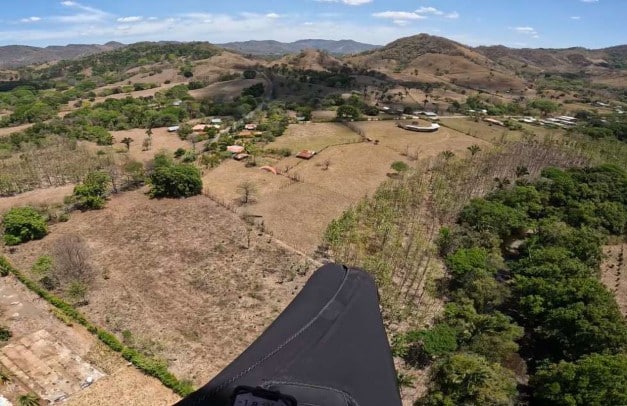
At first glance inconspicuous strange place, not particularly unkempt, but when it starts in the morning, giving experienced pilots a chance to look at one flight day just above several national parks, including the iconic Arenal volcano and lake of the same name. It flies in the east flowing mountain rib pulled into the landscape in front of the hill.
Turrialba
So if you emit from San Jose to the Caribbean, give yourself at least an hour forum, because the traffic in San Jose is rough, slow, plodding. It then fits somewhere on the way to stop and stretch elytra. The opportunity for flying, in an easterly direction from San Jose but unfortunately not much. But when you go from Cartago on the road number 230 and right at the foot 3 000 m volcano Turrialba, 12 kilometers before eponymous town, you will be on your left pass a restaurant with a tap on La Pastora, which incidentally leads to the summit of this volcano, 100 meters behind her, then the left-hand stop at a small buffet and you’re facing him with grass take-off sleeves. It is easy to find.
It is also about the fact that nobody needs and problems if it landed anywhere you thought would trouble sooner or later probably were. Of Costa relationship to take private property so to speak more seriously than we’re used to from our country. Just follow the boundaries of land or pre-arranged space for takeoff and landing – it is the foundation of long-term sustainability of such sports among which include paragliding. That’s not only in Costa Rica and they have.
 The starting is great, grassy, super in all directions. Thus, besides towards the root wastewater treatment h. Such bit smelly five meter pool at the bottom side of the runway. So there is not to be wind or bow out there to land on landing at the start. That would be a bit uncomfortable. Landing on top but otherwise is quite simple, we can say that the ideal for his training. Well, it’s also far more practical than the land down under at the start of the last visible field house.
There are barbed wires between the box and then it takes a bit before someone comes to you. The quad. There goes after private tractors rutted road in the fields of local farmers. From the start, turn right and after 300 meters again right to the gates of the entire agricultural land. Pass the round building that looks like a horse training.
There are cows. Flying under Turrialba is a nice slope on a large extended rib, before it can fly for regular thermals, flocks of birds of prey circling her like his show. Local conditions so they want that flight is almost always only cloud base during the day instead of the pitch, rather declining. And so low that it covers the entire runway and goes away.
Rivas
This start we had at the very end of the event because apparently it’s the best, most mountainous and aesthetically interesting, what Costa Rica offers pilots. Rivas is a village near the town of San Isidro de El General. Either you go down the road of Dominical number 243, or you can go from San Jose on the road number 2, Costa Rican part of the legendary Panamericana. And when you get off the mountain passages back down into the valley, you are in San Isidro.
On Riva’s runway leads the way for ATV – Calle Tirra. Incidentally, this is the same path that takes you from the starting point of two kilometers of gravel in turn leads to the Panamerican. The first runway is natural mountain zebra, grass and applicable to the southwest wind. Above it is a special built a watchtower rather prospect, round glass, comfortable seating inside – incredible views. Joy but also makes other pilots, while on the second start made by an excavator in a lava slope painstakingly weigh belts grassy carpets. This is directly to the south flow. Cumulus jumping regularly before noon, there is no reason not to jump to that already a little earlier than we’re used to with us.
But what is a bit more challenging it is to hit the landing, so if you decide to hang out around the chimney. One little difficult landing strip is relatively rugged terrain just above small football pitch and the second – more confident, more is on the soccer field at the bottom of Rivas. I do not know why, but the football fields in the vicinity of Rivas suspicious lot. Maybe it will be also the fact that in this village a cosmic rich people are buying up huge land and build there his hacienda. Well, those are small private airport, whether they have to get.
Dominical is to fly over from Rivas launch apparently real, it needs a high base and regularly tease. Well, like everywhere else you want from the mountains grovel through a long valley to the other hills on the other side.